
The project will setup in the Baltic Sea the world-wide first testbed for the new maritime terrestrial backup system, R-Mode, that utilises two so called maritime signals-of-opportunity at once. This is an important step towards the resilient provision of Positioning, Navigation and Timing (PNT) information on-board a vessel which is requested by maritime organisations. The institute will focus in this project on the R-Mode signal design for ranging transmissions in medium and very high frequency band, development of methods for range and position estimation, integration of R-Mode into a PNT data processing unit and international standardisation of R-Mode. The DLR leads this Flagship project of the EU Strategy for the Baltic Sea Region (EUSBSR). Project partners are national maritime administrations, research institutions and industry from four European countries.
Global Navigation Satellite Systems (GNSS) are today the primary source for PNT information for safety relevant maritime operations. GNSS based PNT data are used as an input for different systems e.g. Automatic Identification System (AIS) and position display on Electronic Chart Display and Information System (ECDIS). The worldwide availability and high performance of GNSS makes it such a valuable tool for mariner. But GNSS is vulnerable as it was shown in different studies. Interferences caused by natural sources but also man-made can provoke degradation of service performance and furthermore loss of availability. Therefore, mariners worldwide looking for a backup system which can support them with sufficient accurate positioning and timing for save completion of begun operations. International bodies, as for example the International Maritime Organization (IMO) and the International Association of Marine Aids to Navigation and Lighthouse Authorities (IALA) currently strengthen their efforts for more reliable PNT systems.
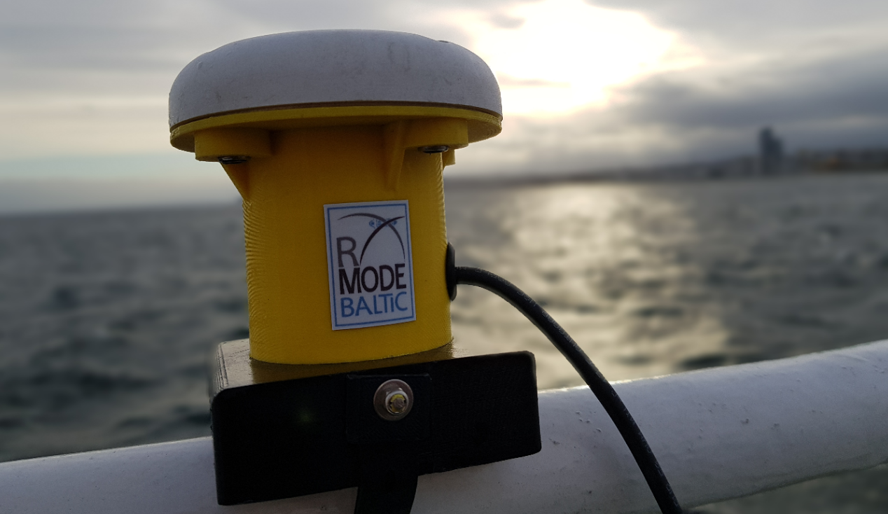
R(anging)-Mode is a technology that utilises existing maritime radio beacons or AIS base stations by adding ranging signals to the legacy transmission scheme. Until 2020 the R-Mode Baltic project team will establish the world‘s first R-Mode testbed in the Baltic Sea, utilising both station types, and will develop first user applications demonstrating that R-Mode is able to meet maritime user requirements for a backup system. The project team works in the following six main topics.
MARITIME RADIO BEACONS provide differential corrections for GNSS by low data rate transmission in the medium-frequency radio band around 300 kHz. Based on already available R-Mode developments using continuous wave and the legacy signal, the project team will investigate methods to solve the signal wave ambiguity error by advanced signal design and signal processing. Furthermore, methods will be developed to mitigate the impact of skywave-induced fading. Up to six radio beacons will be upgraded to fully support the R-Mode technology.
AIS BASE STATIONS provide information from shore using AIS messages transmitted in the very high frequency (VHF) radio band around 162 MHz. The project team will test implementation of R-Mode on AIS and VHF Data Exchange System (VDES) signals. An optimal signal design will be selected and algorithms for range estimation will be developed. The data channel load will be considered. AIS base station equipment of four stations will be adjusted for the transmission of R-Mode signals.
TIME SYNCHRONISATION OF R-MODE TRANSMITTER is a crucial issue for a terrestrial backup system because the transmitters must operate with a mutual time accuracy of a few 10ns. The project will analyse the performance of currently available time comparison methods and station clock alternatives, and will suggest a suitable R-Mode timing infrastructure. Furthermore, self-synchronisation of R-Mode will be studied. A proof-of-concept of a transnational cost-efficient time synchronisation solution with suitable hold over clocks at the transmitter sites will be developed and demonstrated.
R-MODE POSITIONING will be based on range estimations to the different transmitter sites. An assessment on how the potential sources of errors affect the R-Mode system’s performance and reliability supports consideration if circular and hyperbolic lateration methods will be used for positioning. Based on existing GNSS receiver platforms, hardware for two prototype receivers and processors with different levels of integration will be developed. The software included will meet the R-Mode requirements and will include the project research results on R-Mode positioning methods. At the end of the project, the prototypes will be tested extensively to demonstrate the capability of the R-Mode technology.
TWO R-MODE APPLICATIONS will be developed. An existing prototype of a PNT Data Processing unit will be upgraded to support R-Mode receiver raw data input. This approach facilitates the position calculation based on R-Mode signals transmitted by maritime radio beacons and / or AIS base stations. In the case of loss of GNSS positioning, it will automatically provide an R-Mode based position. Secondly a portable pilot unit (PPU) will be equipped with an R-Mode module. With GNSS available, the unit works in its standard operation mode. Once GNSS positioning fails, it will automatically switch to R-Mode operational mode. The R-Mode PPU will provide information regarding the active positioning mode to the pilot via its display.
R-MODE STANDARDISATION is a prerequisite for the distribution of r-mode technology because maritime radio beacons and AIS base stations are designed to meet international standards, recommendations and guidelines of IALA, IMO, ITU, IEC and others. Therefore, the implementation of R-Mode technology on these stations requires the change or at least amendment of existing international standards. The project team will forward to, communicate with and encourage various standardisation committees and international organisations to improve and broaden the scope of existing PNT standardisation by the implementation of the R-Mode technology.
Duration: October 2017 til September 2020
Funding: co-financed by European Union through European Regional Development Fund within the Interreg Baltic Sea Region Programme
Projct recognition: Flagship der EUSBSR
Project lead: DLR e. V.
Project partners
Germany
- Federal Waterways and Shipping Administration
- Federal Maritime and Hydrographic Agency
- navXperience GmbH
Sweden
- Swedish Maritime Administration
- RISE Research Institutes of Sweden AB
- Gutec AB
- Saab AB (publ) TransponderTech
Poland
- Maritime Office in Gdynia
- National Institute of Telecommunications
- NavSim Poland Sp. z o.o.
Norway
- Kongsberg Seatex AS
Project website: www.r-mode.eu
[:]