
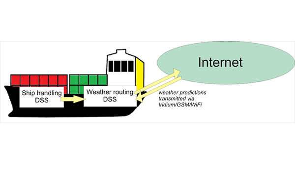
The project aims at developing a new type of ship routing solution taking into account weather conditions (weather routing) with improved assessment of ship performance and responses to sea conditions, utilizing weather predictions with increased accuracy and reliability. Uncertainty level in the ship’s environment description would be reduced by the application of ensemble forecasts and continuous measurements of ship motions and weather conditions by an on-board monitoring system. The proposed system would comprise of two Decision Support Systems (DSS), namely Ship Handling DSS and Weather Routing DSS. The former would be responsible for continuous measurements of the ship motions and generating alerts in case of dangerous operations. The DSS would include devices for registering the motions in the six-degrees of freedom and associating the measurements to a specific ship position and speed. The Weather Routing DSS would in turn optimize the routes while taking into account the previous DSS data and weather predictions with their accuracy improved by the measurements. The system will also allow to exploit the information provided by the monitoring system to check the accuracy of the weather forecast and to adjust it according with real measurements along the route.
All the methods and algorithms will be implemented in commercial Electronic Nautical Chart environment (NaviWeather by NavSim). The full developed scheme will be installed in the oceanographic ship in Portugal and tested in regular operations and real environmental conditions.
Designing a method quantifying the uncertainties of weather forecasts, updating them with real measured data and improving the models of ship motions and performance, would result in improvement of the quality of route recommendations. This in turn would contribute in reducing both fuel consumption and ship pollutant emissions, increasing safety on-board and facilitating port and offshore scheduling processes.[:]